What Is AIS Data?
What Is AIS Data?
— The system that reveals the positions of ships across the ocean
Hello! This is OceanLook — the eyes of the ocean.
When you look out at the sea, countless ships are moving across the water. But how do we know where these ships are headed, or what kind of vessels they are?
The answer lies in AIS data.
What Is AIS?
AIS stands for Automatic Identification System.
In simple terms, it's a system where ships broadcast their own position and information.
Each vessel is equipped with an AIS transponder that periodically sends signals like:
“I'm here!”
“I’m Vessel XX!”
“I’m heading at XX speed in this direction!”
These signals are received by coastal receivers or satellites orbiting the Earth.
What Kind of Information Does AIS Provide?
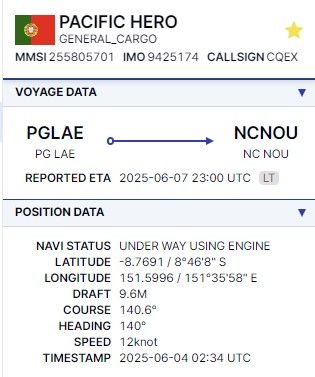
AIS broadcasts include a variety of real-time data, such as:
- Current location (latitude & longitude)
- Speed and course
- Vessel name and MMSI (unique ID)
- Ship type (e.g., container ship, tanker, etc.)
- Destination and Estimated Time of Arrival (ETA)
- Dimensions, call sign, and more
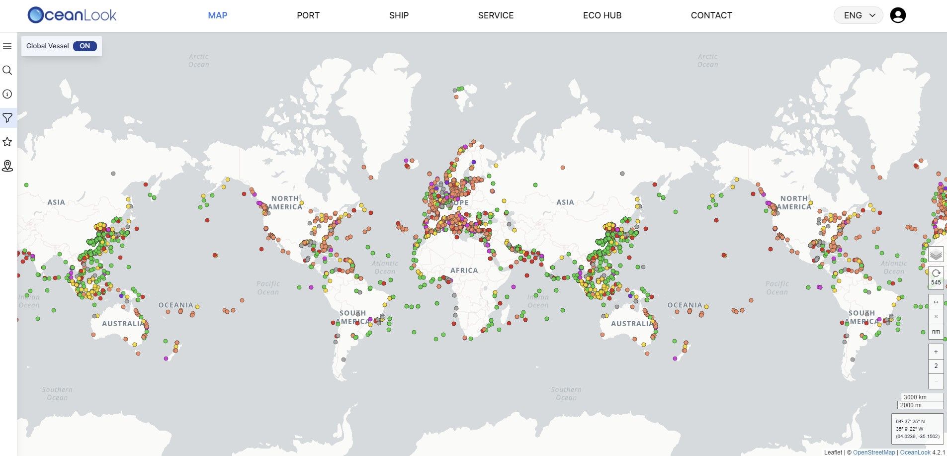
This data allows us to display the exact location and movement of ships on a map in real time.
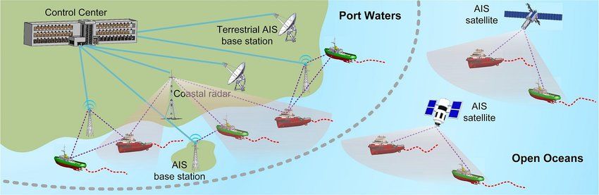
Types of AIS Data
AIS data is collected in two main ways:
1. Terrestrial AIS (Land-Based Receivers)
- Captures signals near coastlines
- Fast and cost-effective
- Coverage limited to areas near land
2. Satellite AIS
- Global coverage, even in open oceans
- Allows tracking of ships far from shore
Are There Any Limitations to AIS?
Yes — while AIS is powerful, it does have some limitations:
- Intentional signal disabling
→ Some vessels may turn off their AIS to conceal illegal activities like smuggling.
- Spoofing
→ Deliberately transmitting false information or fake positions to mislead others.
- Signal blind spots
→ In remote ocean areas, signals may be weak or lost altogether.
Because of these factors, AIS is often used in combination with other technologies like satellite imagery or radar for more accurate maritime monitoring.
In Conclusion
AIS data is like a navigation system for the sea.
It helps us visualize the real-time movements and locations of ships, making our oceans safer and more efficient to navigate.
As global trade, maritime security, and logistics continue to grow, AIS will play an even more vital role in the years to come.
This was OceanLook — your window to the world’s oceans.